South Florida Braces for Increased Showers and Thunderstorms Amidst Tropical Moisture Surge
A weather disturbance near the Bahamas is bringing increased tropical moisture to South Florida, leading to a higher chance of showers and thunderstorms, particularly in Broward and Palm Beach counties. The weather is expected to remain hot and humid with…
 Miami Fort Lauderdale, FL, August 7, 2026 —
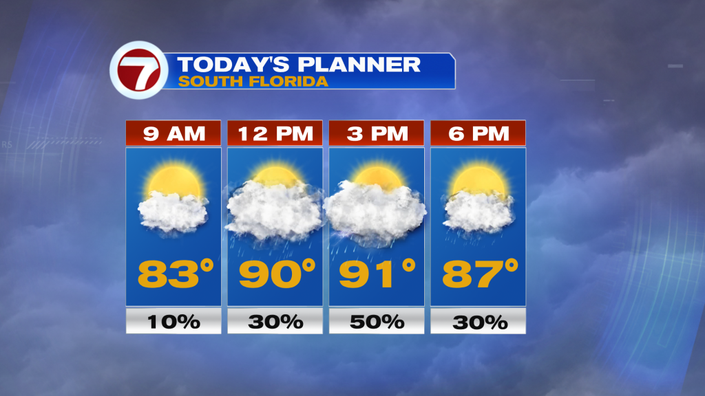
South Florida is experiencing an increase in tropical moisture due to a weather disturbance located near the Bahamas. This influx of moisture is contributing to a heightened probability of showers and thunderstorms across the region, with Broward and Palm Beach counties being particularly affected.
The forecast indicates that the weather will remain hot and humid. Elevated chances for rain are expected to persist through early Saturday. Residents and visitors should be prepared for potential precipitation and the continuation of warm, moist atmospheric conditions.
The disturbance’s proximity to the region is the primary driver for the shift in weather patterns. Meteorologists are closely monitoring its development and track, although specific details regarding its intensity or potential long-term impacts beyond the immediate forecast period were not provided in the summary.
The increased moisture content in the atmosphere typically leads to more widespread cloud cover and a greater likelihood of convective activity, resulting in the forecast for more frequent showers and thunderstorms. These conditions are common during periods when tropical systems or disturbances influence the weather across South Florida.
Authorities have not issued any specific advisories or warnings, but the public is advised to stay informed about weather updates. The hot and humid conditions, combined with potential rainfall, may lead to localized flooding in low-lying areas and should be considered when planning outdoor activities.
Story summarized from the original created by Vivian Gonzalez on wsvn.com, see more information here.
Media gallery